Geek Patio
For a while now, I've had the idea that I'd add a little hardscape next to my shed as a place to set up my telescope. I wasn't very enthusiastic about the work involved, until my wife suggested that I align it to the stars somehow. Suddenly I was fired up about the project, and my wife immediately dubbed it the Geek Patio. I ordered the Silver Creek imitation slate octagon patio kit from Home Depot (delivered free) and the paver base and sand from Lowe's (because Home Depot didn't offer delivery of that stuff on their Web site). [Update: I think Silver Creek still makes these, but Home Depot no longer carries them.]
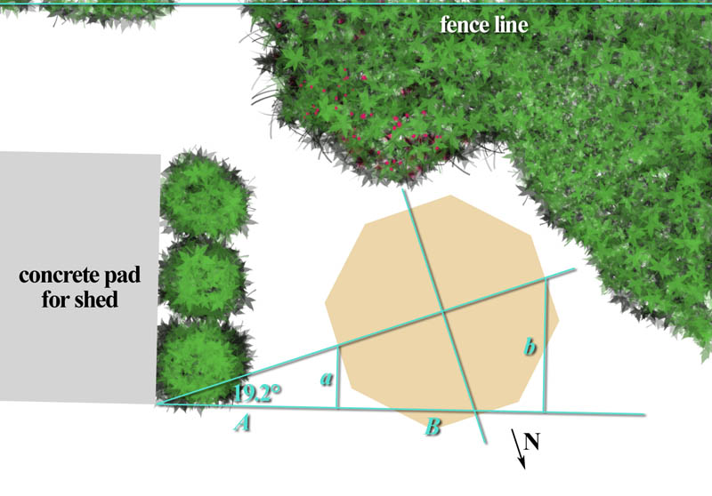
I can see my fence line in the Google Maps image of my house, which gave me the angle I needed to align the patio. But thick brush makes it hard to measure from the fence. Instead, I used the front edge of the concrete pad under my shed as my baseline. It turns out the pad isn't exactly parallel to the fence (it's off by about a degree), so I had to take that into account.
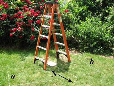 With a little trig (and some string, tent stakes, a tape measure, and a
carpenter's square), I was able to lay out my fundamental north-south line and
the center of the patio. To verify my north-south line, I hung a plumb line
from the top of a ladder, directly over my center point, and waited for local
noon.
With a little trig (and some string, tent stakes, a tape measure, and a
carpenter's square), I was able to lay out my fundamental north-south line and
the center of the patio. To verify my north-south line, I hung a plumb line
from the top of a ladder, directly over my center point, and waited for local
noon.
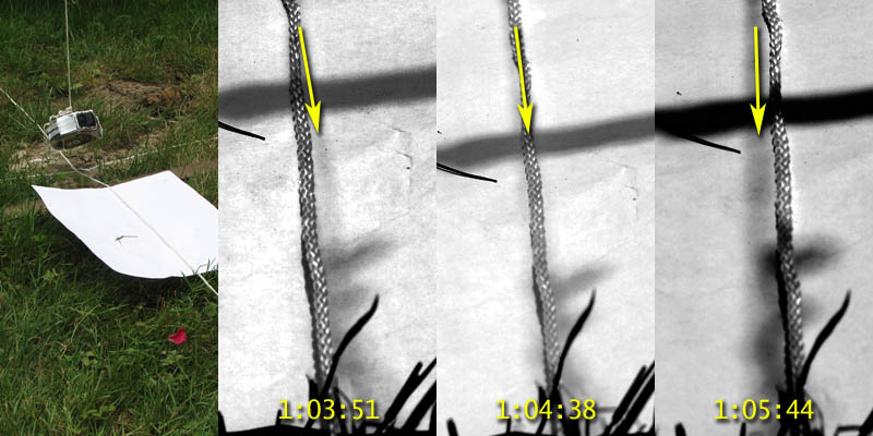
The shadow of my plumb line would point due north at local noon, the time when the Sun sits exactly on the celestial north-south line (the meridian). The three pictures of the plumb line's fuzzy shadow falling on my north-south string were taken about a minute apart, with the one in the middle taken at local noon. This shows that a deviation of even a fraction of a degree would be surprisingly easy to see.
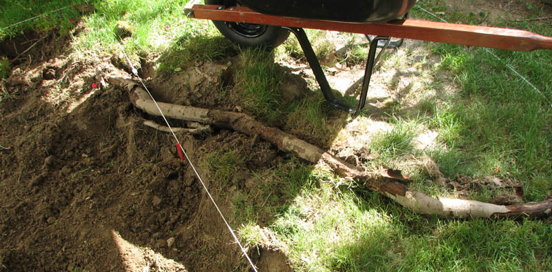
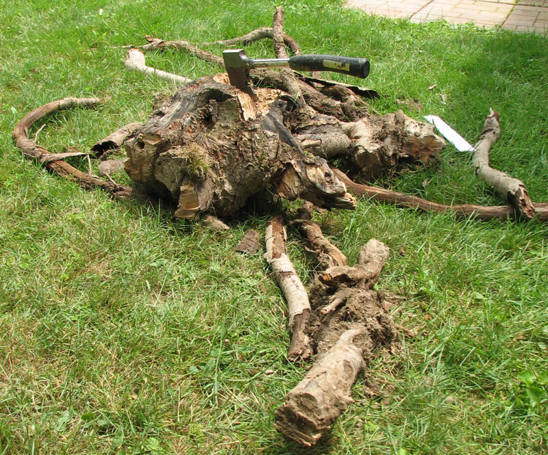
The site of the patio included the stump of a weeping cherry that I'd cut down over ten years ago. I'd hacked out the stump a couple of weeks earlier, but the roots were still criss-crossing the site and had to come out.
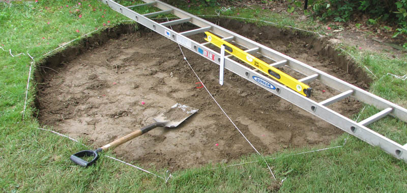
Here I'm checking both the level of the site and the depth of the hole, which needed to be six inches. The center of the patio is marked by a piece of red yarn tied to the north-south string.
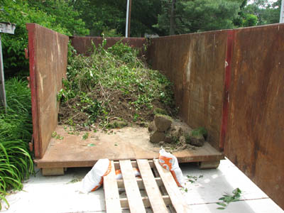

About 23 cubic feet of dirt came out of the hole. We rented a rolloff (a kind of dumpster) to put it in, which my wife is also using to clear a lot of weeds, ivy, and other unwanted plants (a stray 12-foot oak tree!) out of our shrubs. The dirt is replaced by 37 bags of paver base and sand and 25 concrete pavers. Together they weigh roughly one and a half tons, and they had to be transported about 100 feet by wheelbarrow. Ugh.
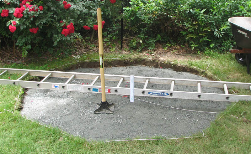
I'm checking that I have three inches of paver base. I leveled and compacted the base material with a hand tamper. The base I used is a rough, pulverized gray stone ranging from dust to pea size shards. Probably something like lunar regolith.
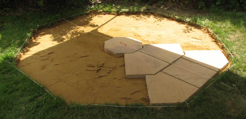
When I started laying pavers, I ignored the perimeter string, which was only there to tell me where to dig. I aligned the paver seams with my north-south string, measuring from my center mark (the red yarn).
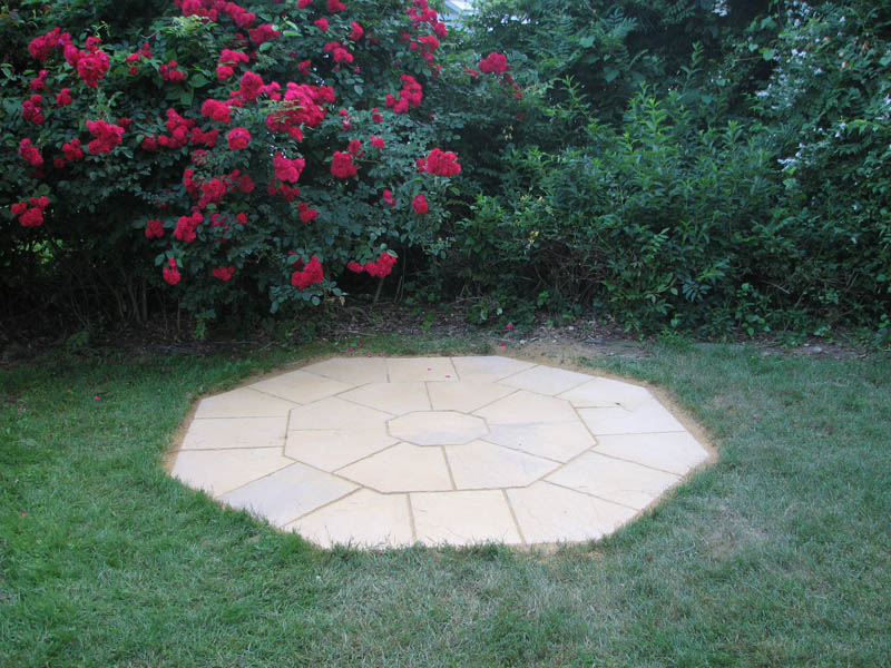
Finished! Mostly. I plan to mark the compass points somehow, maybe with metal letters epoxied to the pavers, or something painted on. I haven't figured that out yet.
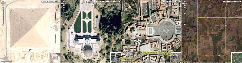
Meanwhile, I can't wait for Google Maps to update the image of our house. The geek patio will join an interesting list of structures that are curiously aligned, including the Great Pyramid at Giza, Griffith Observatory in Los Angeles, Saint Peter's Basilica, and the roads and property lines in much of the western United States.
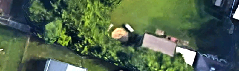
Update: Well, I didn't have to wait long
at all. Google updated the aerial view of my back yard. You can now see the
patio! Some of it is obscured by shadows and foliage, but the north edge is
pretty clear. The ears
are two benches that I made from wood I recovered
from our old swing set.
Update: An even better Google Maps image.
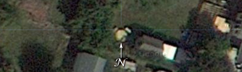
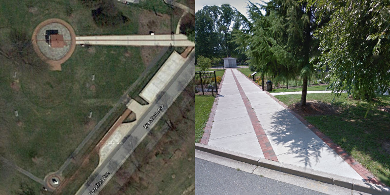
Update: Observatory Park, not that far from me, is the site of the Gaithersburg (Maryland) Latitude Observatory. This is one of six international sites created at the turn of the twentieth century to study the Chandler wobble, a slight motion of the Earth's rotational axis. The path from Desellum Avenue to the observatory structure is aligned east-west, following the 39° 8' 12.5" N latitude of the telescope. About 60 meters due south of the building is a meridian marker used to align the telescope.
Ernie Wright
Last modified 4 July 2018
